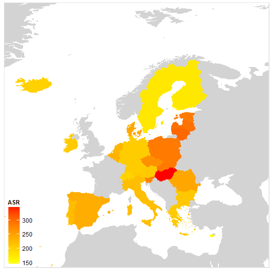
Map from world map in R / 2
https://github.com/briatte/kmaps
> setwd("C:/Users/batagelj/Documents/papers/2018/CRoNoS/shape/nEarth")
> library(ggplot2)
> library(rgeos)
> library(maptools)
> gpclibPermit()
> library(RColorBrewer)
> library(reshape)
> library(plyr)
> source("../theme.R")
> map <- readShapeSpatial("ne_50m_admin_0_countries", proj4string = CRS("+proj=longlat"))
> names(map)
> map <- rename(map, c(ISO_A2 = "iso2")) #; summary(map)
> eco <- subset(read.csv("../iarc.eco.2008.csv", header = TRUE, sep=","), iso2 != "EU27")
> dim(eco) #; str(eco)
[1] 30 48
> map@data$id <- rownames(map@data)
> map.points <- fortify(map, region = "id")
> map.df <- join(map.points, map@data, by = "id")
> map.df <- join(map.df, eco, by = "iso2")
> kmap <- ggplot(map.df) +
+   coord_cartesian(xlim = c(-24, 46), ylim = c(31, 79)) +
+   aes(long, lat, group = group) + geom_path(color = "white") +
+   geom_polygon() + theme_map()
> plim <- c(min(eco$mr_m), max(eco$mr_m))
> map.df.missing <- subset(map.df, is.na(mr_m))
> kmap <- kmap +
+   geom_polygon(data = map.df.missing, aes(long, lat, group = group), fill = "lightgrey") +
+   scale_fill_gradient("ASR", limits = plim, low = "yellow", high = "red") +
+   aes(fill = mr_m)
> kmap
Except where otherwise noted, content on this wiki is licensed under the following license: CC Attribution-Noncommercial-Share Alike 3.0 Unported
