[[notes:da:eumap]]
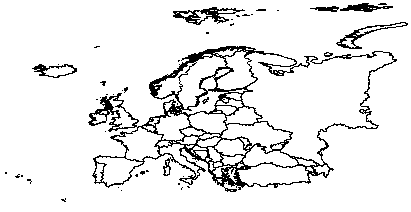
Map of European Countries
Cyprus, Poseidonia, April 2-6, 2018
> library(maptools)
> library(rgdal)
> setwd("C:/Users/batagelj/Documents/papers/2018/CRoNoS/shape/Europe")
> Eu<-readShapePoly ("Europe.shp")
> plot(Eu)
> names(Eu)
[1] "NAME"      "ORGN_NAME"
> Eu$NAME
 [1] Albania
 [2] Andorra
 [3] Austria
 [4] Belgium
...
[51] Svalbard (Norway)
[52] Turkey
[53] Ukraine
[54] Russia
54 Levels: Albania ... United Kingdom
We manually constructed the file alpha2.csv linking countries on the map to their ISO two letter codes.
> CE <- read.csv("alpha2.csv",sep="\t",header=TRUE,skip=2,colClasses=c("numeric","character","character"))
> str(CE)
'data.frame':   56 obs. of  3 variables:
 $ n     : num  1 2 3 4 5 6 7 8 9 10 ...
 $ NAME  : chr  " Albania                 " " Andorra                 " " Austria                 " " Belgium                 " ...
 $ alpha2: chr  "AL" "AD" "AT" "BE" ...
> library(stringr)
> CE$NAME <- str_trim(CE$NAME)
> Eu2 <- CE$alpha2
> Eu2
 [1] "AL" "AD" "AT" "BE" "BA" "HR" "CZ" "DK" "EE" "FI" "FR" "DE" "GI" "GR" "GG"
[16] "HU" "IE" "IM" "IT" "JE" "LV" "LI" "LT" "LU" "MK" "MT" "MC" "ME" "NL" "NO"
[31] "PL" "PT" "SM" "RS" "SK" "SI" "ES" "SE" "CH" "GB" "AM" "AZ" "BY" "BG" "FO"
[46] "GE" "IS" "SJ" "MD" "RO" "SJ" "TR" "UA" "RU" "VA" "KX"
Except where otherwise noted, content on this wiki is licensed under the following license: CC Attribution-Noncommercial-Share Alike 3.0 Unported
